The Tatoosh Mountain
Range lies just south of the towering Mount Rainier within the national park.
It runs east to west and, per Wikipedia, includes 25 named prominent peaks. The
traverse links together 12 of the most prominent ones and then follows a section
of the Wonderland trail to return back to the start.
I have attempted the
traverse twice. The first two times we started at Snow Lake trailhead and
ended up bailing at the mid-point down the Pinnacle Peak trail due to
exhaustion and slow moving. Continuing on past Pinnacle Trail is very
committing due to the remaining 6 peaks followed by the 1600 feet of climbing
up the Wonderland trail back to the car, which would occur later in the
evening making hitching back to your car an unlikely option.
This attempt Brody Hatch
and I were committed. We had a better idea of what we were in for. We
also had learned from multiple previous time and moral wasting wrong turns
which ways not to go. We arrived at the Snow
Lake trailhead late Saturday night, August 12th 2018, and got 4-5 hrs of sleep in the van. We hit
the trail running at 4:34am. The night was very cool and damp due to the
rainfall the day prior and the forecast was perfect with cooler temperatures
and low chance of rain.
Heading up to Unicorn
Peak took us up past Bench and Snow Lakes where the maintained trail stopped. We followed the canyon up a large boulder field, trending left up a steep chute
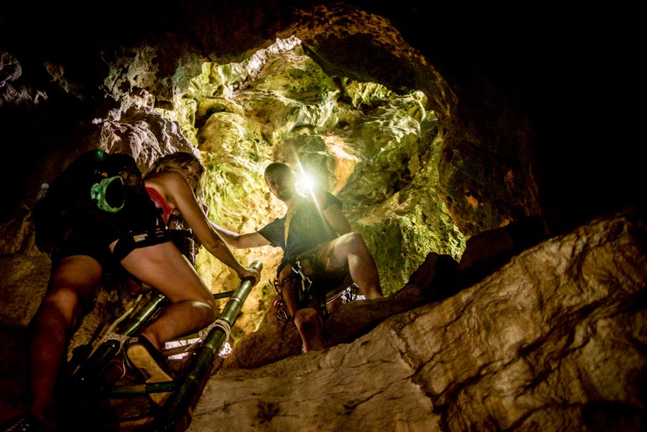
with flowing streams to the base of the peak. There we found a time saving climbers trail to traverse the loose scree to a steep 4th class chossy wet pitch taking
us to the saddle between Unicorn and West Unicorn Peaks. On a prior attempt we
included West Unicorn which falls in line on the traverse, discovering that
coming off of the back side was completely heinous due to huge amounts of
loose rock and scree in steep chutes. We both appreciated that the established
traverse didn't include it. From the saddle we followed the small trail up to
the summit of Unicorn which has a distinct pointy rock feature on top (maybe
that is how it got its name) which required maybe 5.5 level climbing moves and
was wet from dew. Peak one, check.
Next was Stevens Peak
which required dropping down into minimal visibility, relying on GPS, to find
the saddle between the peaks. GPS saved the day as dropping down to early or
late could have put us in some tough spots. Obtaining Stevens ridge was fairly straightforward,
trending right to avoid a large cliff band and then heading up a bunch of loose
rock to the final portion of the ridge before topping out. Peak two. Check!
Coming off of Steven had screwed us up in the past because we dropped down to
early and got to low on the mountain. This time was not the case and we were
back at the saddle below Unicorn.
 |
| Looking at the base of Unicorn from Stevens. A wrong turn on the Unicorn descent could put you into that. |
Next was Boundary Peak
which lies directly south of Unicorn. We headed up a visible rocky chute to the
climbers left after passing through a boulder field and then up the ridge.
Getting around and up the summit required traveling on the left (west) side of
the ridge below a few large cliff bands and then coming up a steep gully, and
following the rocky ridge to the summit. Peak three. Check.
 |
| View of Mount Rainier from the Unicorn saddle. |
Next was Foss Peak. From Boundary we dropped off down to the same saddle
between Unicorn and West Unicorn. Views is this section were amazing as the
clouds parted, allowing full view of the mountain. We down climbed the 4th
class choss of Unicorn's west base and skipped across the boulder field under
West Unicorn to catch the far side of the canyon. After obtaining the far ridge
we followed it up to Foss which was straight forward. From the top of Foss we
could see Snow and Bench Lake far below. Our shoes were soaked through from the
dew which was unavoidable. Peak four. Check.
Next came The Castle. We
dropped off of Foss down a steep grassy face, passing a small pond and caught
the mellow ridgeline up and over a smaller high point and to the base of The Castle on a trail. We followed the ridge up to
the base of a large rock feature which earned the peak its name. The prior
attempt we had been overconfident and had each attempted to free solo up
different random lines which had both ended up in extremely focused down
climbing after thoughtful risk assessment. Following the base around to
climbers right presents two fairly straight forward 5.5 level climbing options.
An exposed ridge traverse takes you to the true summit. We could see hikers far
below the shear cliff on the other side. There were rappel rings set up from
near the summit. We down-climbed our ascent route without problems. Peak five.
Check. We passed some climbers in with climbing gear hiking up to climb the route as we headed down.
 |
| The Castle ridge line. |
 |
| Down climbing off of The Castle. |
Pinnacle Peak was next,
which is a more commonly climbed peak due to the easy access from the Pinnacle
Peak Trail. We dropped off of The Castle, bumped over a steep spine on a
climbers route, down through some steep trees and onto the open bowl. Using the
GPS we found a trail up high just below the cliff line that saved time getting
us over to the the base of Pinnacle. Heading up Pinnacle there isn't much of a
specific route, just a loose steep rock face on the far side (west) leading up
to the summit. The summit was a rocky point with great views of Rainier. This
was our bailout point. Brody's knee started acting up coming down off of Foss,
likely IT band issues. When I asked him if we were going to go for it, his
response was, "We'll at least get to Plummer" (the next peak) which
wasn't incredibly promising. Our socks and shoes were soaked and our feet were
getting trashed. We put on fresh dry socks, making our feet feel brand new, and
headed down the loose ridge to catch the well established trail over to Plummer.
 |
| Heading over to Plummer with Pinnacle Peak and Pinnacle Peak Trail in the background. |
Getting to Plummer Peak
was the most straight forward peak of the day, following a well established
trail, passing a few families with children on the way up and meeting a family
at the top. Peak seven. Check. Brody's knee was feeling better and we decided to go for it.
Getting over to Denman
was quick. We dropped left off the Plummer trail and caught another small trail
that led over to the south ridge of Denman and followed it up to the summit.
Peak eight. Check.
Heading over to Lane
Peak I believe there was also a very lightly traveled trail. As we approached
Lane we could see a group of two climbing up, which could be concerning for rock
fall. We headed up a loose gully and trended left around and up. This section
was extremely loose and maybe 5.3 level climbing moves. Peak nine. Check.We met
the group of two women at the top who were doing the lower half of the
traverse, having started at Pinnacle Peak Trailhead. We had a short hello and
they let us descend in front of them. We dropped down the same way we climbed up
and scooted right when we got to the gully. From the top of Lane we could see
the route heading up to Wahpenayo which consisted of a long traverse below two
rocky features and then heading up a wide grassy steep chute.
 |
| Coming off of Lane. |
Starting along the
traverse over to Wahpenayo there was a light trail that continued up the first
saddle which was not were the GPS and the prior beta had directed to go. I
ran up to check it out hoping we could stay on a trail, but the destination of the
trail wasn't visible and we made the decision to continue on across the loose,
grassy, steep, horrible traverse. This traverse was the worst part of the day.
Each step resulted in sliding rocks or sliding on vegetation with small rocks sliding down and hitting our ankles. We tried to stay
high but maybe it is faster to stay low where it is lower angle, or to follow
the trail over the first saddle. I don't know the answer. We slowly worked our
way over to the wide grassy chute and was able to get on some firm rocky
features headed up the chute which allowed faster moving. When we got to the saddle we
followed the ridge line through some very very dense narly pine trees coming
very uncomfortably near to some cliffs. It may be faster to stay on the shelf
just below the ridge and loop around up to the summit. Following the ridge came
to a very narrow steep notch that luckily allowed passage and then over a high
point and on to the summit which was pretty ill-defined except for the surveyor
marker. Peak ten. Check. While on the summit I switched out my socks, having hung
my other wet socks on my pack to dry. Brody realized that one of his socks
came off during the traverse across the Wahpenayo ridge which was a costly
loss, as his feet got completely trashed with maceration and a deep fissure
between his toes later on that day that prevented him from completing the whole
loop.
Coming off Wahpenayo and
over to Chutla followed the ridge and then turned off to the right (north)
catching a fairly obvious trail that traversed across below the ridge to the
saddle between the two peaks. I had previously been to the top of Wahpenayo,
having come up from Eagle Peak Trail and was familiar with the route. From the
saddle we dropped down a steep well formed unofficial trail that dropped down
below the steep rocky ridge of Chutla. There was a trail that headed up to the
ridge from the saddle but I am not sure if the route was solo-able, and it
looked pretty rugged, so we opted for the previously traveled path. We followed
the trail across and cut off staying high, cutting up about the 2nd or 3rd
steep grassy gully and caught the ridge path at the top of the gully, headed
right on the trail, up the ridge and ticked the summit. Peak eleven. Check.
Heading over to Eagle
Peak there was a pretty good trail, as this is more commonly traveled by the
many day hikers that access via Eagle Peak Trail. We came up on a group of
young adults, having just randomly popped out of the bushes. "Was there a
trail there?" they asked. "Sort of", Brody responded. They
laughed and we quickly explained that we had been going all day and was doing
the traverse. I guarantee they had no idea what we were talking about so we
just kept moving. We hit the saddle, which is the end of the maintained Eagle
Peak Trail and then up the ridge of Eagle Peak, through some tight trees, up a
few climbs and bam! Peak twelve. Check. We only spent a moment on the summit
taking in the view of Rainier and looking over towards Eagle North Peak that is
not part of the official traverse.
We returned back to the
saddle and got into the rhythm of running for only the second time since
initially running up Snow Lake Trail. Finally a solid maintained trail. Our
feet burning with every step from being wet all day and doing so much rocky
travel. We hit the trailhead at the bottom and celebrated knowing we beat the
FKT for the traverse by about and hour. We walked over to the Longmire
trailhead on the road. Brody's feet were wrecked and he decided to wait at
the the general store. I took the GPS watch, rotated my socks, and headed up the Wonderland trail.
I passed a few people and tried to keep a slow jog/shuffle. I missed the
turnoff where the trail crossed over the Nisqually River and wandered around
for awhile watching my GPS and finally figured it out. The trail gains more
elevation once you cross the river and climbs up along the Paradise River. I
eventually topped out at Reflection Lake and followed the trail down to Louise
Lake where I made a frustrating error and stayed on the Wonderland trail, dropping
down below but parallel to the road, rather than transitioning to the road. I incorrectly thought that there was a
small spur trail when it reached Snow Lake Trailhead. I got to where the spur
trail should have been and with every turn expected it. Shit!! I was wrong. I
now had the choice of backtracking uphill on the trail for about 0.25 miles or
bushwhack it through dense steep vegetation up to the road. I went with the
bushwhacking. 15 minutes later, with some extra thorn scrapes and extremely
frustrated I popped out of the thick mess and onto the road just barely below
the trailhead at 7:35pm. I stopped the watch! I made it!
I walked up to the van,
opened the door, stripped my shoes and took some water. There was a group of
over fed tourists nearby who were taking a smoke break during their exhausting
drive to and through the park. They asked me about my day and were extremely
bewildered when I tried to explain to them that I had been going since 4:30am
and had climbed the whole ridge line. I popped a warm Rainier and headed down
to pick up Brody and we made the drive home deciding that we were not going to
think about doing this again until maybe next year.
Lessons learned and ways
to improve on future attempts.
- Bring a fresh pair of socks for the run up Wonderland
trail if there is dew and rotate pairs on the traverse.
- While heading up the Wonderland I lost about 20-25 minutes due to missing the turn over
the Nisqually River and by having to bushwhack up the final section to the
van. Don't do those things!
- Ways to possibly travel faster that could be attempted
include: avoiding the nasty traverse coming up to Wahpenayo by following
the trail over first saddle or going below the traverse; traveling on the
shelf just below the ridge coming up to Wahpenayo to avoid the narly
ridge; following the ridge up Chutla rather than going around and up the
gully.
Stats
- 26.5 miles
- 15 hours, Car to car
- 13,514ft elevation gain
- 12 peaks
Splits
- Snow Lake TH 4:34am(0)
- Unicorn 6:05am(1:33)
- Stevens 7:39am(3:07)
- Boundary 9:05am(4:33)
- Foss 10:08am(5:36)
- The Castle 10:46am(6:14)
- Pinnacle 11:26am(6:54)
- Plummer 12:12pm(7:40)
- Denman 12:32pm(8:00)
- Lane 1:13pm(8:41)
- Wahpenayo 2:58pm(10:26)
- Chutla 3:48pm(11:16)
- Eagle 4:16pm(11:44)
- Eagle Peak TH 5:10pm (12:38)
- Longmire TH 5:18pm (12:46)
- Reflection Lake 7:02pm (14:30)
- Snow Lake TH 7:35pm (15:00)


